 |
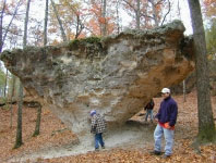
Roadcuts Ky I 64 in vicininity of Owingsville, east of Lexington and west of Morehead - Kentucky
|
 |
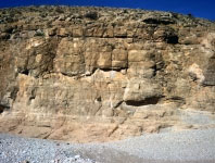
Roadcuts exposed along Kentucky AA Highway south-east of Maysville
|
 |
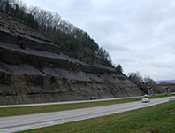
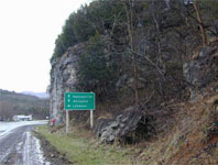
Roadcuts on Ky State Rt 627 between I 75 & I 64 - to SW of Winchester
|
 |
Roadcuts on junction off the AA Highway on Ky Route 62, west of Maysville, and the southern bank of Ohio River
|
|
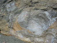
US 58 Virginia, close to Dickensonville between St Paul and Hansonville
|
|
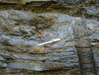
US Rt. 58 east of St Paul and near Hansonville Virginia
|
|
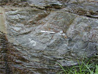
Roadcuts exposed along US Rt. 58 close to Lebanon, Virginia
|
|
Roadcuts exposed along US Rt. 58 close to Hansonville, Virginia
|
|
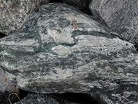
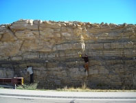
Outcrops of metamorphic rocks exposed along I 26 from Ashville towards Johnson City just north of the North Carolina-Tennessee border
|
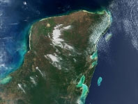 |
Holocene carbonate depositional systems of the marginal marine of Belize. Images of reefs, lagoons, and tidal flats, as well as maps and cross sections
|
|
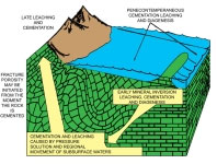
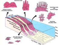
Diagrams and photographs tracking the variable settings of carbonate diagenesis. |
|
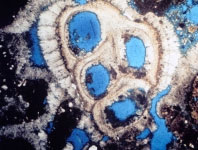
Diagrams and photomicrographs that track a variety of carbonate porosity types and some of their geologic controls
|
|
|
|
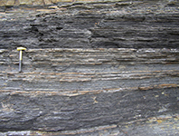
Ross formation - Deepwater Fan Lobe Sheets, Channels & Local Small Slumps
|
|
|
|
Ross formation - Deepwater Sheet Lobes and Channeling |
|
|
|
Ross formation - Deepwater Sand Sheets with Low Relief Channel Incision
|
|
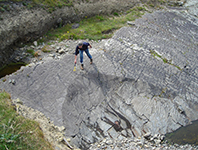
Ross formation - Megaflutes and Deepwater Channels
|
|
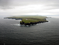
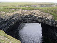
Ross formation - at Bridges of Ross North of Shannon Estuary
|
|
Ross formation - Deepwater Channels, Slumps and Submarine Sand Volcanoes
|
|
Deepwater Margin Slumps and Condensed sequences downslope from Basin margin
|
|
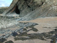
Deltaic sediments of the Tullig formation at Trusklieve, Co Clare
|
|
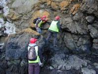
Doonlicky formation - Listric faulting of the deltaic sediments exposed in the cliffs
|
|
|
|
E xposures of the Doonlicky formation Clastic Cycles |
|
Outcrops of Permian sediments that show broad generalities of slope margin, submarine fans, and the channels that feed them
|
|
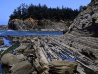
G raded beds illustrated with a number of the fining upward Bouma sequences common to many turbidite terrains |
|
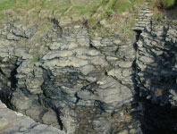
Flute casts, prod and other tool marks, eroded grooves and gutters, and the load casts from sediment dewatering
|
|
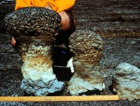
Submarine volcanoes and ichnofossil structures formed by dewatering of sediment and being weighted down by the arrival of a downslope transport event
|
|
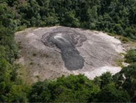
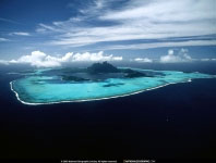
Diagrams and photographs of the geology of Eniwetok Atoll and Bora Bora
|
|
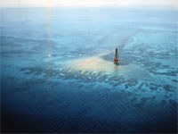
Geology of the Florida Keys
|
|
Geology of the Florida Keys
|
|
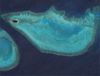
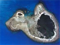
Buildups in the Great Barrier Reef Australia at Heron Reef
|
|
Buildups in the Great Barrier Reef Australia at Heron Reef
|
|
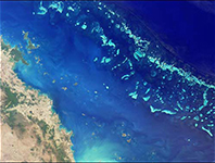
Great Barrier Reef
|
|
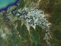
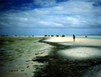
Regional aerial shots and photographs of the region in the vicinity of the Norman River and Karumba
|
|
Nassau River and Leichardt River and Sweers Island, Van Der Lyn Island and North Island and the Bauxite Pisolites deposites at Weipa
|
|
|
|
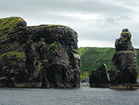
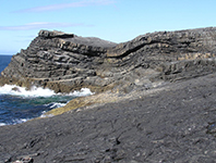
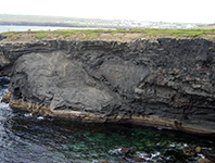
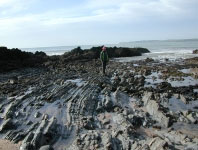
Southwestern end of Hook Head adjacent to the lighthouse
|
|
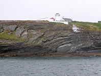
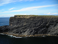
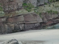
West side of Hook Head
|
|
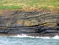
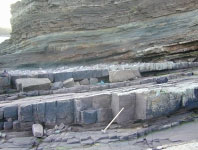
Sandeel Bay on east side of Hook Head
|
|
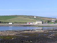
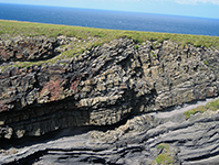
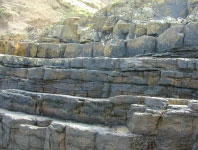
East side of Hook Head
|
|
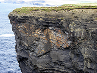
West side of Hook Head
|
|
West side of Hook Head
|
|
West side of Hook Head beneath the town of Duncannon
|
|
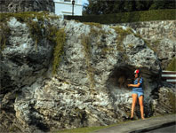
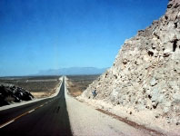
US Route 23 just North East of Lousia, Kentucky
|
|
|
|
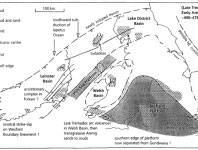
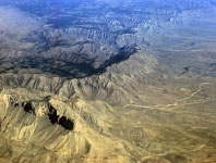
Jurassic and Devonian carbonates in the High Atlas Mountains of Morocco |
|
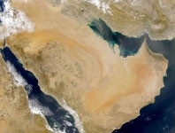
Images primarily taken from NASA
|
|
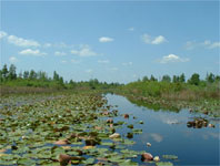
Widespread open prairie swamps with hammocks
|
|
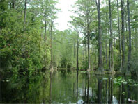
Billies Lake, Minnies Lake, Floyds-Prarie and Billies-Island
|
|
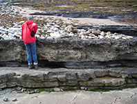
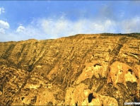
Outcrops exposed in Preserve accumulated in the middle Eocene and were deposited when the sea level was about 125 meter higher than the present.
|
|
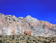
Guadalupe Mountains and buried in the adjacent subsurface
|
|
Guadalupe Mountains and buried in the adjacent subsurface
|
|
Guadalupe Mountains and buried in the adjacent subsurface
|
|
Guadalupe Mountains and buried in the adjacent subsurface
|
|
Guadalupe Mountains and buried in the adjacent subsurface
|
|
|
|
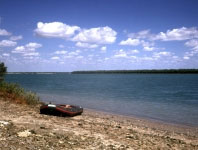
North of Shark Bay and Carnarvon, Western Australia
|
|
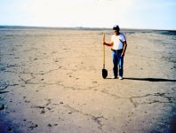
Abu Dhabi Western UAE Coastal Photos and Images
|
|
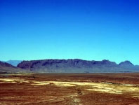
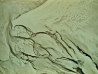
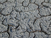
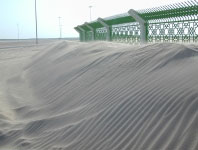
United Arab Emirates (U.A.E.) sabkha flats and aeolian sediments
|
|
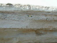
S upratidal evaporite and intertidal cynobacterial mats |
|
S upratidal evaporite and intertidal cynobacterial mats |
|
UAE ADIPEC Conference Field Trip Fabien Kenig North of Abu Dhabi Island
|
Thursday, January 2, 2014