|
EXERCISE
5
Objectives
When you have finished this exercise you will be able to:
Data
- The illustrative
data to be used for the exercise have been saved either in .pdf,
.gif format or .jpg format. These maps and cross-sections can
be viewed and interpreted with a variety of different visualization
software (including but not exclusive of Adobe Acrobat, Adobe
Illustrator, Freehand, Canvas and/or Photoshop) or printed on
a large frame plotter and interpreted by hand. These exercise
illustrations are quite large (up to 500K in some cases) and they
may take a little time to be displayed. Patience will be rewarded!!!!
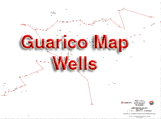
- The clickable map
below is linked to a pdf file which locates the wells of the three
cross sections of this exercise: namely a North-South Dip line
and two strike lines a Northern Strike Line and a Southern Strike
Line.
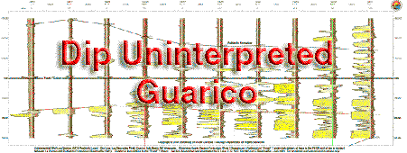
- Use the Spontaneous
Potential and Resistivity
logs displayed on the North South Dip Line
 |
| As an alternative
this map can also be viewed by clicking on the link to a large
.jpg
file |
 |
| As an alternative
this cross section can also be viewed as a large .gif file by
clicking on the North-South
Dip line |
.gif) |
| As an alternative
this cross section can also be viewed as a large .jpg file by
clicking on the North Eastern
Section |
.gif) |
| As an alternative
this cross section can also be viewed as a large .gif file by
clicking on the North Western
Section |
.gif) |
| As an alternative
this cross section can also be viewed as a large .gif file by
clicking on the South Eastern
Section |
.gif) |
| As an alternative
this cross section can also be viewed as a large .gif file by
clicking on the South Western
Section |
Methods
Utilize the Gulf
Coast slip-slide method to help you match the log sections
and identify the same geologic events on the various wells.

Don't forget to use the left and right keyboard arrows to control
the forward and backward motion of the movie so you can review
this as you view it!
- Provide
an overall analysis that describes your conclusions.
As with the earlier four
exercises (Exercise 1,
Exercise 2, Exercise
3 and Exercise 4)
to help with your interpretation of the well logs you should read
the earlier sections related to the
geologic setting of the La Pascua Formation
and the introduction
to the sequence stratigraphy of the La Pascua Formation. From these you
will gain knowledge of the depositional setting of these rocks.
You should combine the techniques outlined above with your understanding
of the regional geology and the vertical and lateral facies relationships
in near shore clastic settings (eg. shoreline,
beach,
stacked
beaches, tidal
flats,
deltas) and Walther's
Law. You should use these to build a depositional model and
a sequence stratigraphic interpretation of the well log section.
|

