More Topics

EXERCISE 4

Objectives

The purpose of this exercise is to enable you to:

Data
  • The illustrative data to be used for the exercise have been saved either in .pdf, .gif and/or .jpg format. These maps and cross-sections can be viewed and interpreted with a variety of different visualization software (including but not exclusive of Adobe Acrobat, Adobe Illustrator, Freehand, Canvas and/or Photoshop) or printed on a large frame plotter and interpreted by hand. These exercise illustrations are quite large (up to 500K in some cases) and they may take a little time to be displayed. Patience will be rewarded!!!!
  • The clickable map below is linked to a pdf file which locates the five wells (me333, me296, me428, me313 and me 486) within the central portion of the Northern Strike Line
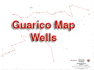
  • As an alternative this map can also be viewed by clicking on the link to a large .jpg file
  • Use the Spontaneous Potential and Resistivity logs displayed on the .pdf file of the cross section 5 wells Guarico linked to the clickable thumbnial.
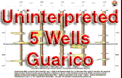
  • As an alternative the above .pdf file this cross section can also be viewed by clicking on the link to a large .gif file
  • You can also view and/or print a smaller version of these files by using your vizualization software to shrink the images to fit your printer.
  • A report describing the high-frequency (fourth-order cycles) sequence stratigraphy and regional geology of this region is provided in the geologic setting of the La Pascua Formation, the introduction to the sequence stratigraphy of the La Pascua Formation and the eustatic chart.
  • A set of maps of previously interpreted wells is also provided to enable the construction of sand thickness isopachs for each of the intervals. Please refer to the basemap for the location of all the wells.

Methods

Utilize the Gulf Coast slip-slide method to help you match the log sections and identify the same geologic events on the various wells.

  • To help with the interpretation of these latter logs an initial correlation has been made with the sections hung on three widespread surfaces. These are:

    • A basal surface correlated to the top of the P-5 silt
    • A surface representing the top of the P-3 silt at the center of the section and around which it is flattened
    • The top of the section is marked by the top of the silt that lies at the contact between the Roblecito and Pascua Formations.
  • Color sands yellow and shales green.
  • Correlate using the Event 7 as your basic datum.
  • For each parasequence identify the TSs (transgressive surfaces) and then correlate these on all the well logs provided. These transgressive correlation surfaces used in all the sets of exercises extend across the area penetrated by the wells, except where they are interrupted by the incision of local channels. These surfaces cap silty horizons that are equated with surfaces of transgression (TS) that formed at wave base, and above, when the sea floor was reworked just following a sea level low (view the movie to understand this).
  • Click on the thumbnail below to view the movie that demonstrates the technique that first uses the transgressive surfaces to build a framework of parasequences from these correlated surfaces and then infills the other surfaces between these as outlined below!


    Don't forget to use the left and right keyboard arrows to control the forward and backward motion of the movie so you can review this as you view it!
  • Normally radioactive peaks on Gamma Ray Logs, associated with mfs, are more extensive and would have been better correlation surfaces than the Transgressive surfaces but Gamma Ray Logs were not available for much of the Guarico Sub Basin. As in the movie above you should use geologic logic to infer the location of the Maximum Flooding Surface (mfs) and correlate these on all the well logs.
  • Thus as shown in the film make a cross-section first correlating the prominent silts for all the wells and then correlating the sands.
  • Pick base of massive sands and correlate these from well to well when they occur on other logs in other wells.
  • Identify the sequence boundaries (SB) at base of the massive sands and correlate these from well to well.
  • Identify all system tracts, including the incised valley, on all well logs.
  • For each parasequence (bounded by mfs's) estimate and record the net sand (in feet).
  • Click on the thumbnial below to view the movie that tracks an interpretation of the character of the sedimentary fill of the Guarico Basin during the deposition of the La Pascua Formation.


  • Don't forget to use the left and right keyboard arrows to control the forward and backward motion of the movie so you can review this as you view it!
  • Provide an overall analysis that describes your conclusions.
  • As with the earlier three exercises (Exercise 1, Exercise 2 and Exercise 3) to help with your interpretation of the well logs you should both view the movies and read the earlier sections related to the geologic setting of the La Pascua Formation and the introduction to the sequence stratigraphy of the La Pascua Formation. From these you will gain knowledge of the depositional setting of these rocks. You should combine the techniques outlined above with your understanding of the regional geology and the vertical and lateral facies relationships in near shore clastic settings (eg. shoreline, beach, stacked beaches, tidal flats, deltas) and Walther's Law. You should use these to build a depositional model and a sequence stratigraphic interpretation of the well log section.

    home | about site | site contents | site map| submit a site | contact us | top
    Copyright © 2009 SEPM (Society for Sedimentary Geology) All Rights Reserved
    Last Revised: November 17, 2005